
california: Mt. whitney (14,495ft)
|
Highpoint details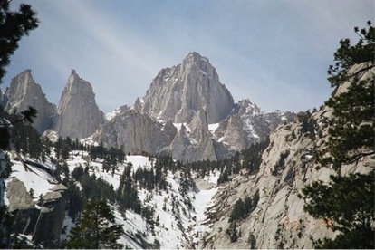
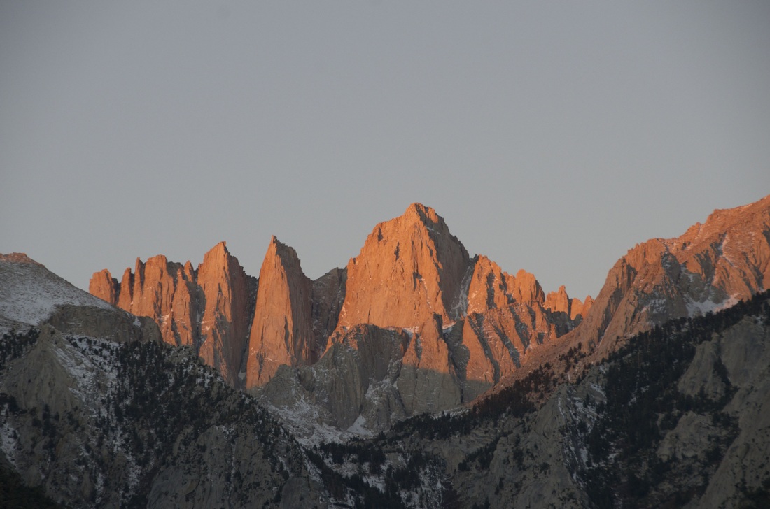
Mount Whitney is the highest summit in the contiguous United States with an elevation of 14,505 feet (4,421 m).[1] It is on the boundary between California's Inyo and Tulare counties, 84.6 miles (136.2 km) west-northwest of the lowest point in North America at Badwater in Death Valley National Park at 282 ft (86 m) below sea level.[6] The west slope of the mountain is in Sequoia National Park and the summit is the south end of the John Muir Trail which runs 211.9 mi (341.0 km) from Happy Isles in Yosemite Valley. The east slope is in the Inyo National Forest in Inyo County.
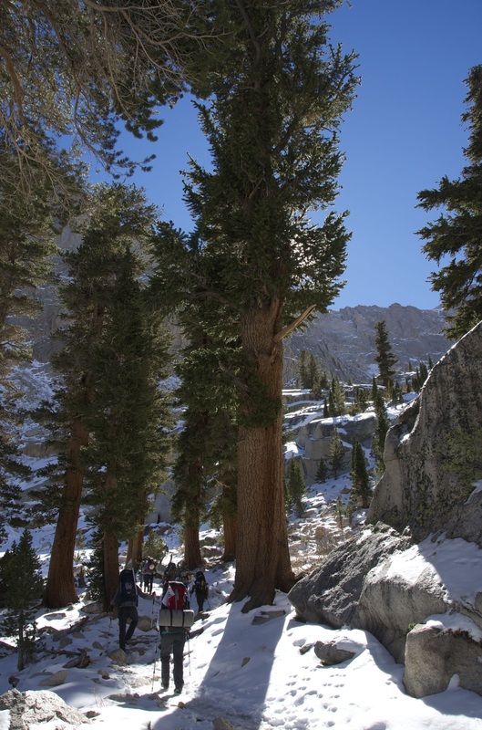
The most popular route to the summit is by way of the Mount Whitney Trail which starts at Whitney Portal, at an elevation of 8,360 ft (2,550 m), 13 mi (21 km) west of the town of Lone Pine. The hike is about 22 mi (35 km) round trip with an elevation gain of over 6,100 ft (1,900 m). Permits are required year round, and to prevent overuse a limited number of permits are issued by theForest Service between May 1 and November 1.[16] Most hikers do the trip in two days. Those in good physical condition sometimes attempt to reach the summit and return to Whitney Portal in one day, thus requiring only a somewhat easier-to-obtain "day use" permit rather than the overnight permit. This is considered an "extreme" day hike, which normally involves leaving Whitney Portal before sunrise and 12 to 18 hours of strenuous hiking,[17] while struggling with altitude sickness, cold air, and occasionally treacherous surface conditions (because snow and/or ice are normally present on parts of the trail, except for a short period from early July to late September). |
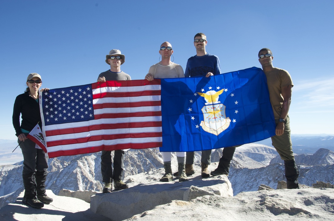
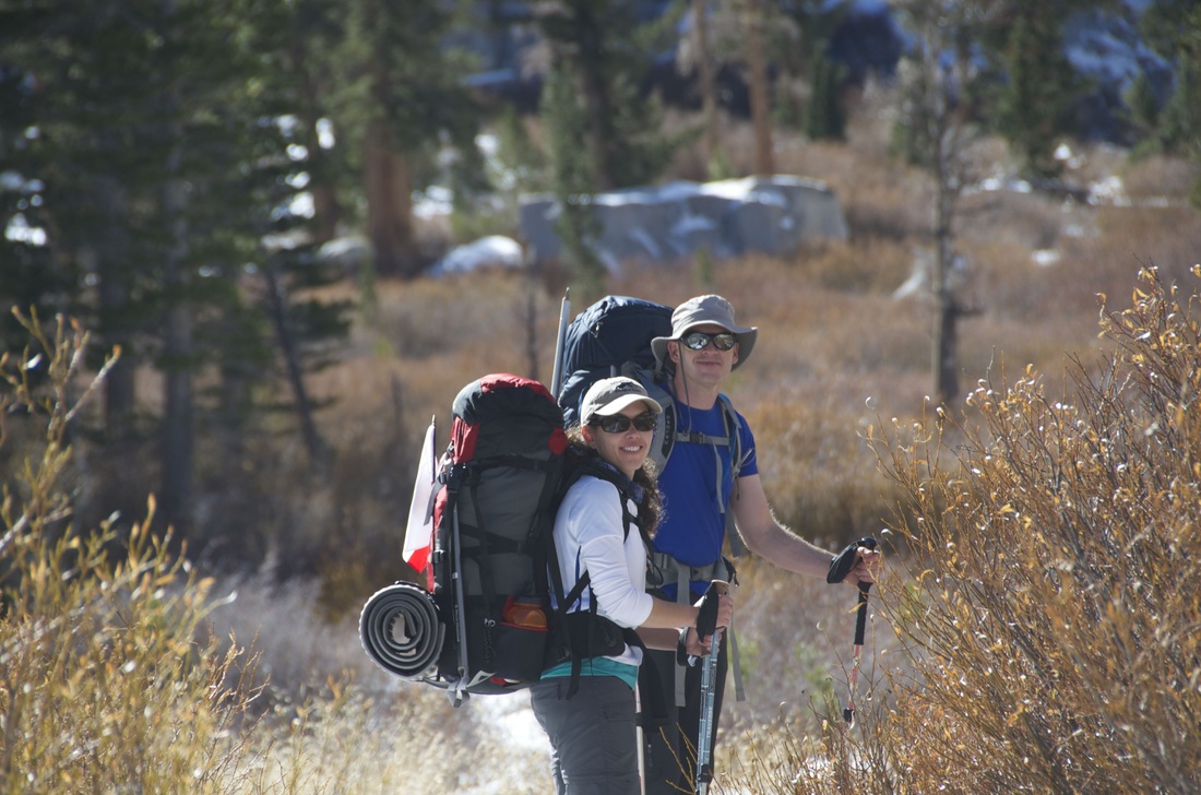
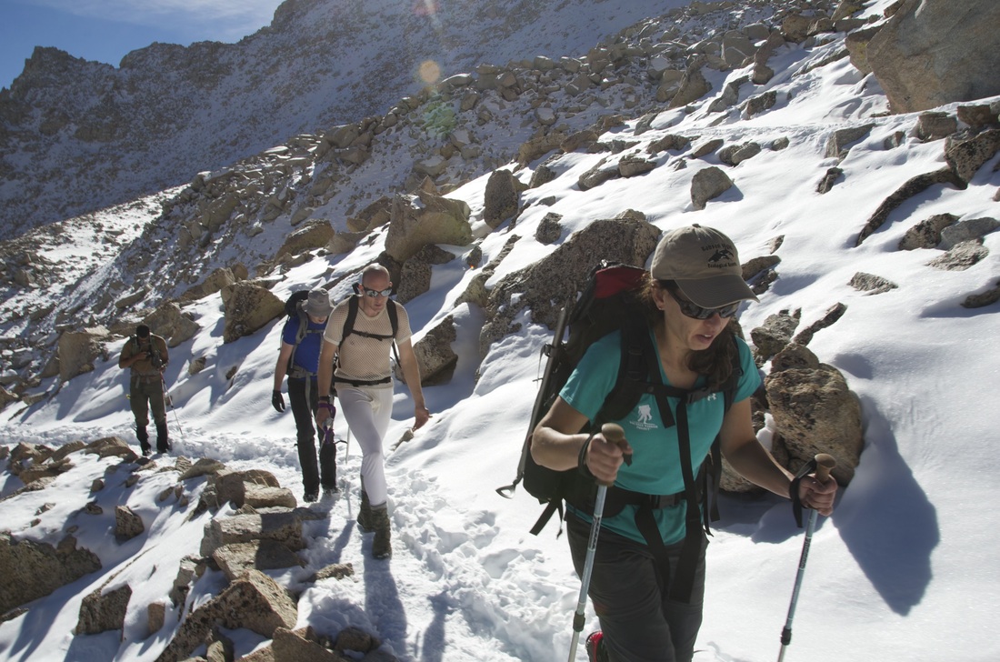
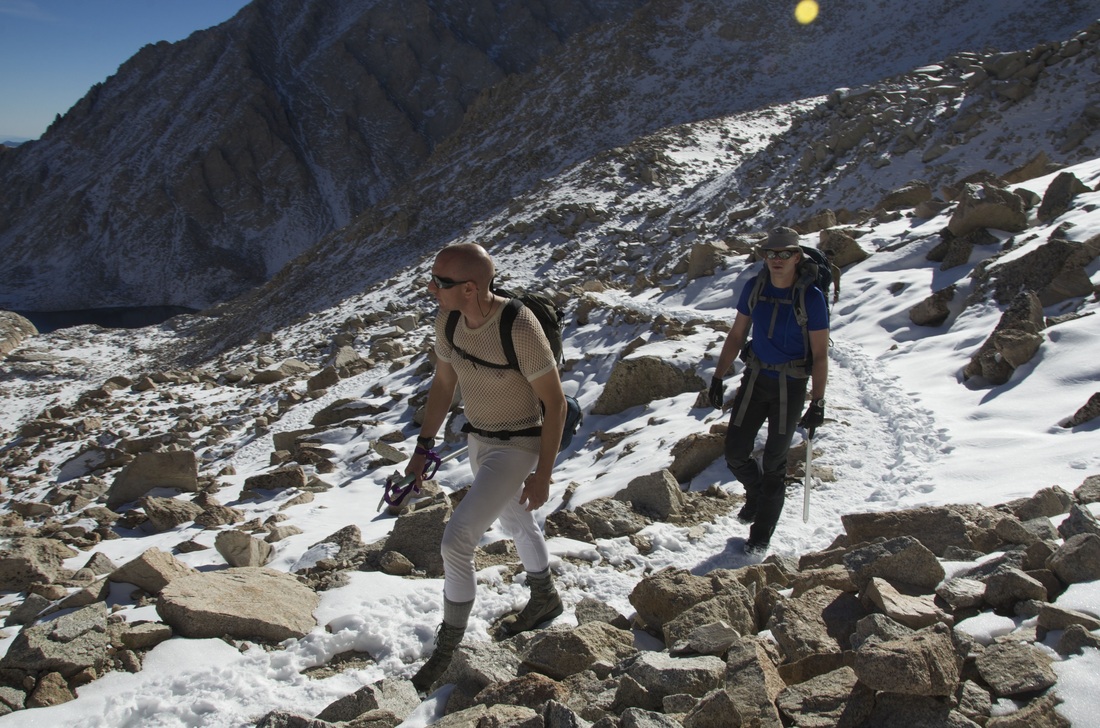
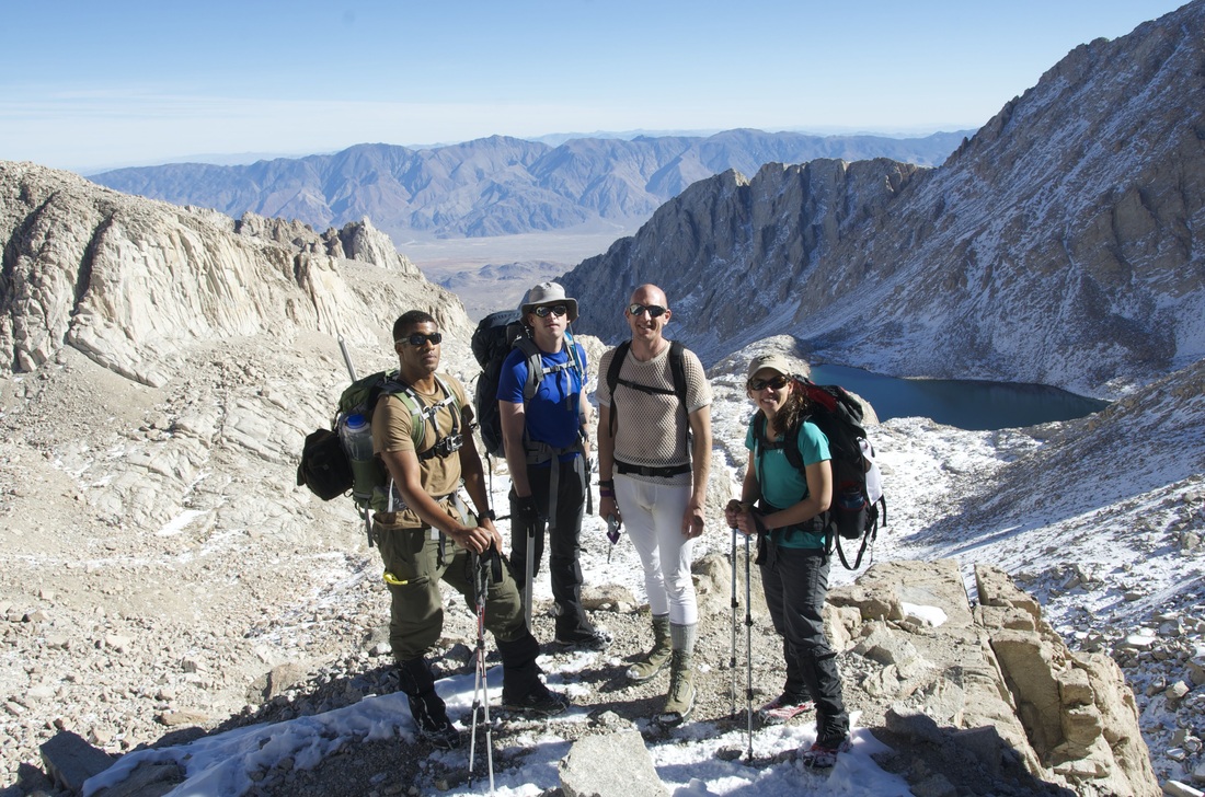
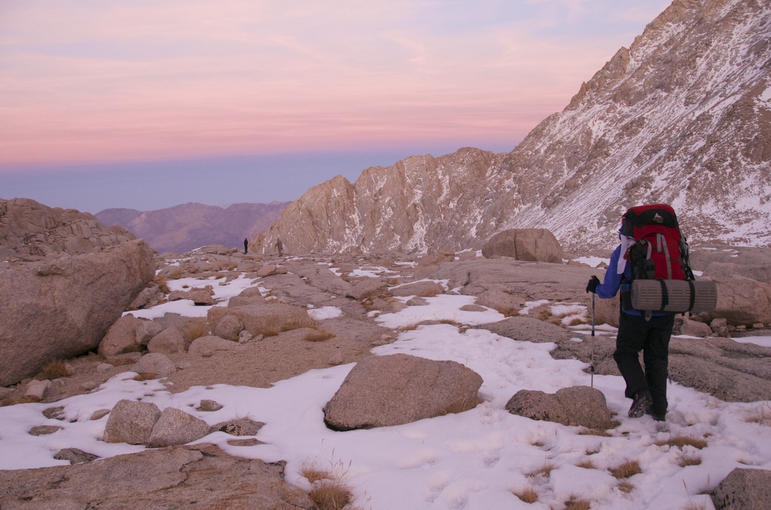
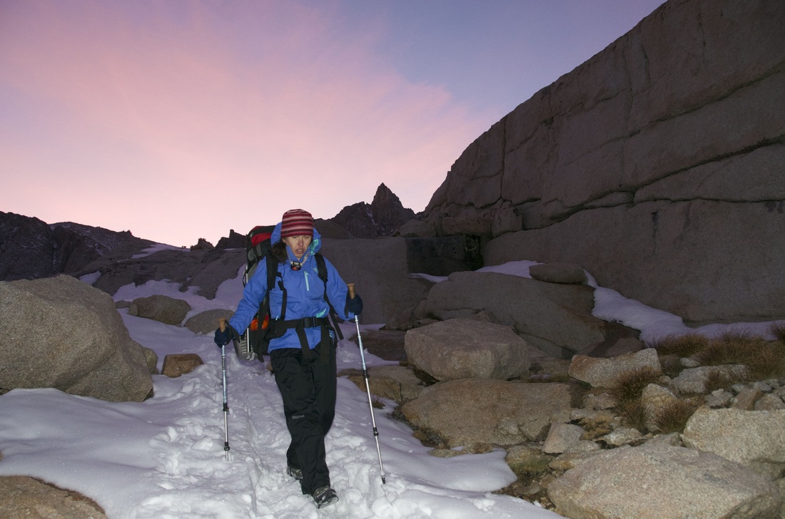
Trip ReportThe USAF 50 Summits Challenge trip to Mt. Whitney was a success! At the basic level, all five climbers stood on the summit with the U.S. and Air Force flags and then made it back down safely. More importantly, we had the privilege of spending a couple days in a stunning location, enjoying each other’s company and the thrill of a physical challenge.
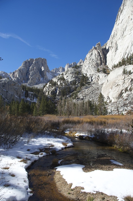
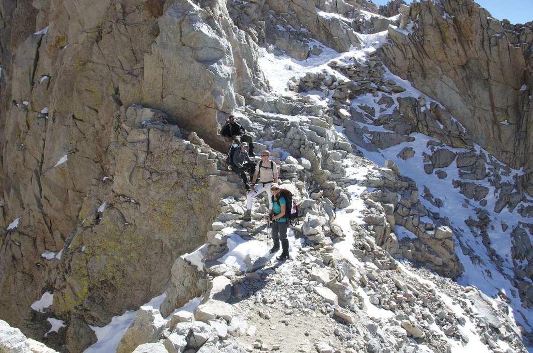
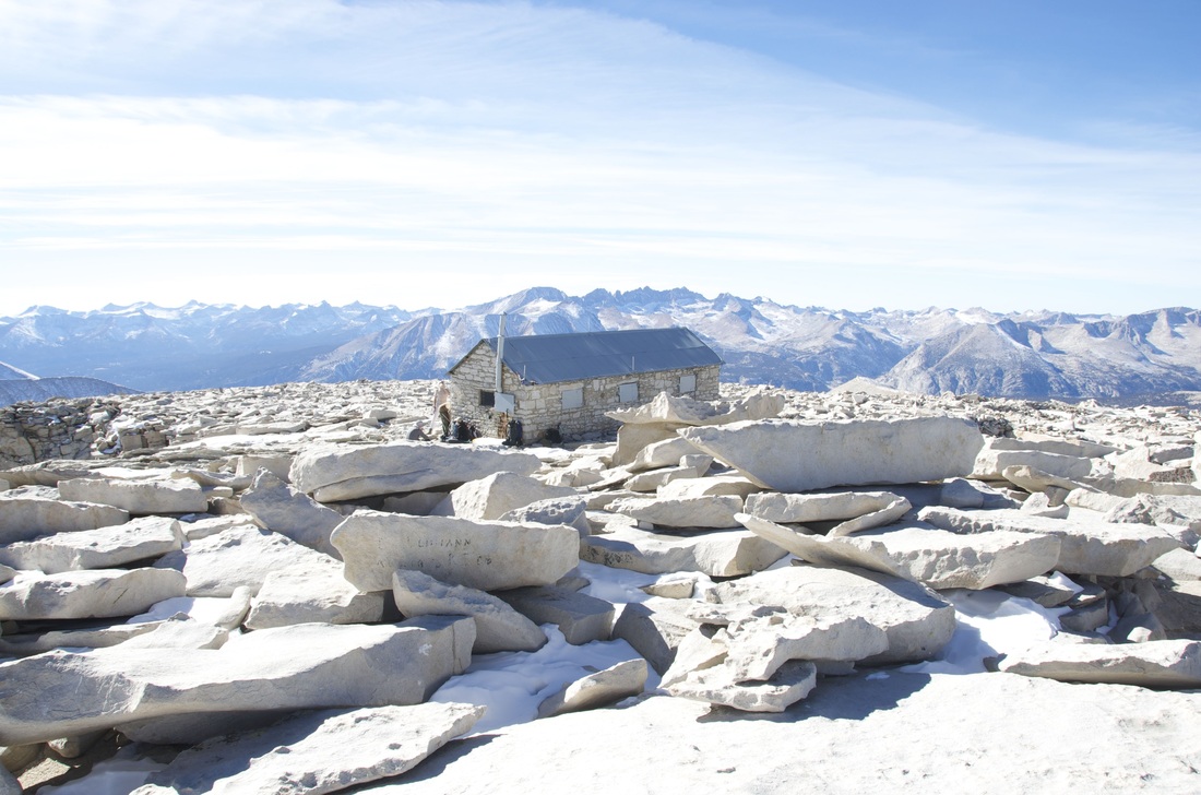
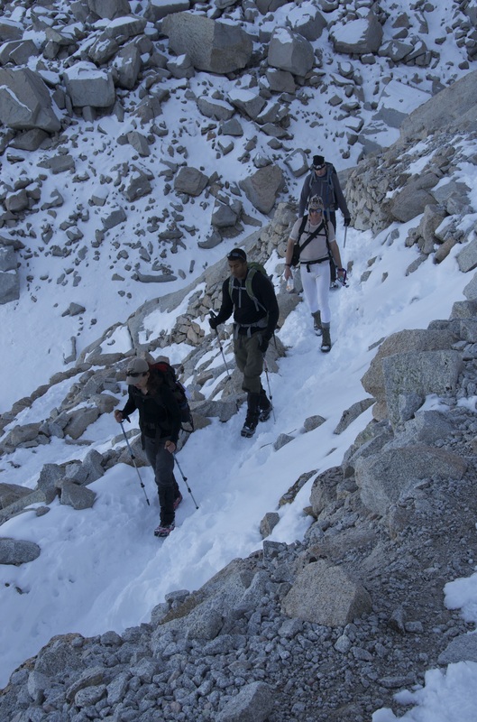
The Mt. Whitney Trail truly is gorgeous. It rises from alpine forest up into cathedral-like spaces of soaring granite walls, topped by the spires of Whitney and the nearby "needles". Of course the visual drama also means physical challenge. The Whitney Trail is well-built and obviates the need of any technical climbing skills, but snow and ice on much of the trail still made footing tricky at times, and we were glad we'd brought microspikes with us to aid in traction. (Thankfully our crampons and ice axes were not needed.) The main challenge, though, was the distance and altitude. The first day was actually not bad, covering 6.3 miles from the trailhead at 8,365' to our camp site at 12,040'. The second day, however, was a bit longer. From the camp we ascended to the summit at 14,491', then returned to the camp and continued down to the trailhead, traversing a total distance of 15.7 miles. From setting out on the trail to reaching the cars took 12 hours and pretty well exhausted all of us. We were rewarded, though, with incredible views, perfect weather, and a summit all to ourselves. We had an awesome time, and we're all stoked to join other airmen on other peaks as soon as we can. --Maj Muller trip detailsTrip Leader: Maj Graydon Muller
Nearest Base: Edwards AFB, CA and Creech AFB, NV Trip Date: Nov 7-8 Difficulty: Moderate. 22 miles round-trip. Nov brings potential for demanding weather conditions. |
All trip updates and progress will be posted in the blog below

California Trip Full
The Mt. Whitney USAF 50 Summits Challenge team is full. This is a long and demanding trip with the potential for extreme weather. A team of five experienced Airmen mountaineers will be taking the USAF and American flags to the top of CA.