
Oklahoma: Black Mesa (4,973ft)
|
Highpoint detailsBlack Mesa is a mesa in the U.S. states of Colorado, New Mexico, and Oklahoma. It extends from Mesa de Maya, Colorado southeasterly 28 miles (45 km) along the north bank of the Cimarron River, crossing the northeast corner of New Mexico to end at the confluence of the Cimarron and Carrizo Creek near Kenton in the Oklahoma panhandle. Its highest elevation is 5,712 feet (1,741 m) in Colorado.[1] The highest point of Black Mesa within New Mexico is 5,266 feet (1,605 m).[2] In northwestern Cimarron County, Oklahoma, Black Mesa reaches 4,973 feet (1,516 m), the highest point in the state of Oklahoma. The plateau that formed at the top of the mesa has been known as a "geological wonder" of North America.[2][3] There is abundant wildlife in this arid prairie environment, including mountain lions, butterflies, and the Texas horned lizard.
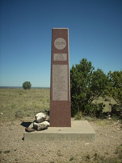
The plateau has been home to Plains Indians.[4] In the early years of the nineteenth century the area was a hideout for outlaws; the notable ones who made this area their hideout were William Coe and Blackjack Ketchum. They even built a fort known as the Robbers' Roost. The stone fort housed a blacksmith shop, gun ports, and even a piano. The present-day Oklahoma Panhandle area which was then considered ano man's land lacked law enforcement agencies and hence the outlaws found it safe to hide in the region. However, as new settlers arrived in the area for copper and coal mining and also for cattle ranching activities by grazing cattle in the mesa region, law enforcement became more effective, and the outlaws were brought under control.[3] A hiking trail of 4.2 miles (6.8 km) (one-way) leads from the preserve to the summit which rises about 800 feet (240 m) above the level of the surrounding plains,[12] and a round trip would take 4 hours at a minimum.[13] Visitors are forbidden from overnight camping.[13] At the highest point within Oklahoma there is an obelisk made of concrete, and also a register of records.[14] Black Mesa is not only the highest point in Oklahoma but it is also the driest, harshest and coldest place in the state. |
trip detailsThis is where the admin will fill in strategic details about the high-point. Roughly when it will occur (until a solid date is picked).
Trip Leader: Nearest Base: Projected Date: Difficulty: Describe how rules are followed: Safety Plan Outdoor Recreation Contacts Chaplains Size/Mix of Group Wounded Warriors Media Outreach |
All trip updates and progress will be posted in the blog below