
New Hampshire: Mt. Washington (6,288ft)
|
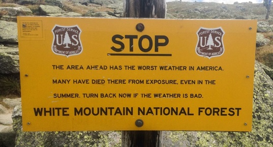
Highpoint detailsMount Washington aka The Rock Pile is the highest peak in the Northeastern United States at 6,288 ft (1,917 m) and the most prominent mountain east of the Mississippi River. It is famous for dangerously erratic weather. For 76 years, until 2010, a weather observatory on the summit held the record for the highest wind gust directly measured at the Earth's surface, 231 mph (372 km/h or 103 m/s), on the afternoon of April 12, 1934.[a] Before European settlers arrived, the mountain was known as Agiocochook, or "Home of the Great Spirit".[5]
The first European to mention the mountain was Giovanni da Verrazzano. Viewing it from the Atlantic Ocean in 1524, he described what he saw as "high interior mountains".[citation needed]The Abenaki people inhabiting the region at the time of European contact believed that the tops of mountains were the dwelling place of the gods, and so among other reasons did not climb them out of religious deference to their sanctity.[6] Darby Field claimed to have made the first ascent of Mt. Washington in 1642.[7] Field climbed the mountain in June of that year in order to display to the Abenaki chief Passaconaway that the Europeans bargaining for tribal land were not subject to the gods believed to inhabit the summit, a primarily political move that facilitated colonists' northern expansion.[6] The summit station of Mount Washington has an alpine climate or tundra climate (Köppen ET), though warming to a subarctic climate (Köppen Dfc) with lower elevation,[13] although it receives an extremely high amount of precipitation, atypical for most regions with such cold weather. The weather of Mount Washington is notoriously erratic. This is partly due to the convergence of several storm tracks, mainly from the Atlantic to the south, the Gulf region and Pacific Northwest. The vertical rise of the Presidential Range, combined with its north-south orientation, makes it a significant barrier to westerly winds. Low-pressure systems are more favorable to develop along the coastline in the winter months due to the relative temperature differences between the Northeast and the Atlantic Ocean. With these factors combined, winds exceeding hurricane force occur an average of 110 days per year. From November to April, these strong winds are likely to occur during two-thirds of the days. Mount Washington once held the world record (still the Northern Hemisphere and Western Hemisphere record) for directly measured surface wind speed, at 231 mph (372 km/h), recorded on the afternoon of April 12, 1934. Although this record was surpassed in Cyclone Olivia in 1996, this wasn't reported as official until 2010.[14] It can still be argued that Mount Washington holds the record for the highest surface wind speed recorded 'by man'; the new Australian record was measured by an automated station while no human was present, while the Mount Washington wind gust was actually measured by a human being. Phenomena measured via satellite or radar, such as tornadoes, hurricanes, and air currents in the upper atmosphere, are not directly measured at the Earth's surface and do not compete with either of these records. The most popular hiking trail approach to the summit is via the 4.1-mile (6.6 km) Tuckerman Ravine Trail. It starts at the Pinkham Notch camp area and gains 4,280 feet (1,300 m), leading straight up the bowl of Tuckerman Ravine via a series of steep rock steps which afford spectacular views of the ravine and across the notch to Wildcat Mountain. Fatalities have occurred on the trail, both from ski accidents and hypothermia. Water bottles may be refilled at the base of the bowl 2.1 miles (3.4 km) up the trail at a well pump near a small hiker's store which offers snacks, toilets and shelter. At the summit is a center with a museum, gift shop, observation area, and cafeteria. Descent can be made by shuttle bus (in the summer) back to the Pinkham Notch camp for a fee. Other routes up the eastern slopes of the mountain include the Lion Head, Boott Spur, Huntington Ravine and Nelson Crag trails, as well as the Great Gulf Trail ascending from the northeast. Routes from the western slopes include the Ammonoosuc Ravine and Jewell trails and the Crawford Path (coincident with the Appalachian Trail from the southwest). **Disclaimer: This is NOT a guided or professional program. All trips are at your own risk and participants must be self-sufficient in terms of skills, equipment, health, etc, for their given environment. The purpose of this is to encourage fellow Airmen to get outside and to help coordinate outdoor events that promote resiliency.** This program is not officially sponsored by the US Department of Defense |
trip details
Trip Leaders: CJ Lenz Nearest Base: 157th ARW, Pease ANGB, N.H. Date: 15 AUG 15. Rain date: 22 AUG 15. Difficulty: Difficult/Strenuous. "To a person unused to mountain trails or in less than excellent physical condition, this unrelenting uphill grind can be grueling and intensely discouraging. If you are not an experienced hiker or a trained athlete, you will almost certainly enjoy the ascent of Mount Washington a great deal more if you build up to it with easier climbs in areas with less exposure to potentially severe weather" (AMC White Mountain Guide) The USAF 50 Summits Challenge is open to any US Airmen and their families/friends. ITINERARY PRIMARY PLAN Wx will be checked 24 hours prior to start of hike as well as day of hike. A go or no decision will be made based on Wx conditions. All participants are responsible for their own:
A WMNF pass maybe needed to park at the trailhead: A free annual pass for us available to U.S. military members and dependents in the Army, Navy, Air Force, Marines and Coast Guard and also, Reserve and National Guard members. Must be obtained in person at a Federal recreation site by showing a Common Access Card (CAC) or Military ID (Form 1173). http://store.usgs.gov/pass/military.html Saturday: Arrive NLT 0745 at trail head near Marshfield Station for showtime (equipment check and safety briefing). Begin hike promptly NLT 0800L in order to summit and return (9.6 miles, 3900 FT elevation gain, 6hr. 40 min.). Ascent: Leave trail head near Marshfield Station. Hike on the Ammonoosuc Ravine Trail until reaching the Lake of the Clouds Hut. If time permits, some participants may want to peak bag nearby Mt. Monroe (0.4 mi away). From the hut we'll take the Crawford Path to the summit of Mt. Washington. Summit: We'll rally at the summit for lunch and have a group photo with the Air Force flag, Air National Guard flag, POW/MIA flag, U.S. flag, and wing flag. Distances from the Base Rd. parking lot (2500').
Descent: Gulfside Trail to the Jewell Trail. Return to trail head near Marshfield Station NLT 2000L. BACKUP PLAN: For those who don't want to hike down, they can take the Cog down to the trail head or the Mt. Washington Auto Road. Note: The auto road will end at Pinkham Notch. SAFETY PLAN: A New Hampshire hike safe card is beneficial to have but strictly optional. http://www.wildlife.state.nh.us/safe/ It is highly recommended that all hikers should have the Ten Essentials. A safety briefing will be given prior to start of the hike. The Ten Essentials:
Also:
Chaplains: Chaplain O. Size/Mix of Group: TBD Wounded Warriors: TBD Media Outreach: PA |
All trip updates and progress will be posted in the blog below
Directions to trailhead: Located on the "Base Rd" 1.1 miles East of the junction with Mt. Clinton Rd and the Jeffferson Notch Rd.
Related Links
New Hampshire State Parks:
http://www.nhstateparks.org/explore/state-parks/mount-washington-state-park.aspx
Mt. Washington Auto Road:
http://mtwashingtonautoroad.com
Appalachian Mountain Club:
http://www.outdoors.org
Cog Railroad:
http://www.thecog.com
Hike Safe
http://www.hikesafe.com
Mount Washington Observatory
https://www.mountwashington.org
Leave No Trace
https://lnt.org/
White Mountain National Forest
http://www.fs.usda.gov/whitemountain
Flags On The 48
http://www.flagsonthe48.org
New Hampshire Fish & Game
http://www.wildlife.state.nh.us
Questions? Email: USAF50SummitsNH@gmail.com