USAF 50 Summits Challenge
  • Home
  • States
  • About
    • About The Challenge
    • Resiliency
    • Guidelines
    • Directors
  • Blog
  • MEDIA
  • Contact

Connecticut: south slope of Mt Frissell (2,372ft)  Ranked #36/50

Picture

Highpoint details

Mount Frissell, 2,454 feet (748 m), located on the border of southwest Massachusetts and northwest Connecticut, is a prominent peak of the Taconic Range. While Bear Mountain, 2,316 feet (706 m), is the highest summit in Connecticut, the highest point in that state 2,380 feet (725 m) is on the south slope of Mount Frissell, along the Mount Frissell trail, a little to the west of the summit 2,654 feet (748). Most hikers reach it by a rather short route starting high up in the col between Mt. Frissell and Bear Mountain, at an elevation of around 1,800 feet (549 m).

The peak and northern part of the mountain are located within Massachusetts. The southern slope of Mount Frissell is located within Connecticut and rises to the highest elevation within that state, 2,379 feet (725 m). Bear Mountain, located 1.3 miles (2.1 km) to the east, is the highest mountain summit in Connecticut.

The mountain is located within the towns of Mount Washington, Massachusetts and Salisbury, Connecticut; much of it has been conserved as part of Massachusetts' Mount Washington State Forest and Connecticut's Mount Riga Forest Preserve. The south side of Mount Frissell drains into Riga Lake and South Pond, then into Wachocostinook Brook, Salmon Creek, theHousatonic River, and Long Island Sound. The northwest side drains into Ashley Hill Brook, thence Bash Bish Brook, the Roeliff Jansen Kill, the Hudson River, and Upper New York Bay. The northeast side drains into Sages Ravine, thence into Schenob Brook, the Hubbard Brook, the Housatonic River, and Long Island Sound. Mount Frissell is bordered by Round Mountainto the southeast, Mount Ashley to the north, and Brace Mountain to the west.

Mount Frissell is traversed by the Mount Frissell Trail which connects with the South Taconic Trail to the west and the Appalachian Trail to the east.

trip details

This is where the admin will fill in strategic details about the high-point.  Roughly when it will occur (until a solid date is picked).

Trip Leader: 
Nearest Base: 
Projected Date: 
Difficulty: 

Describe how rules are followed:
Safety Plan
Outdoor Recreation Contacts
Chaplains
Size/Mix of Group
Wounded Warriors
Media Outreach
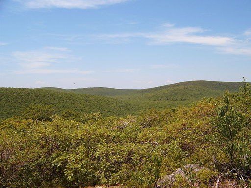
All trip updates and progress will be posted in the blog below

    Connecticut Sign Up

    Enter your information if you're interested in joining the climb of Mt. Frissell!  In comments section, include where you are stationed, what your climbing experience is, and how you would like to participate (climber, driver, support, etc).
Submit

Created by R.Marshall & ROI Online