Maryland: Backbone Mountain (3,360ft)
|
Highpoint detailsHoye-Crest is a summit along
Backbone Mountain just inside of Garrett County, Maryland. It is the highest natural point in Maryland at an elevation of 3,360 feet (1,020 m).[3] The location, named for Captain Charles Hoye, founder of the Garrett County Historical Society, has a marker and offers a view of the North Branch Potomac River valley to the east. The location is accessible via a path leading from U.S. Route 219 to the west. There is no direct road access to Backbone Mountain. The best route is a hike in from a point along U.S. Route 219 just south of Silver Lake, West Virginia at 39°14′43″N 79°29′30″W. From here, one ascends Backbone Mountain along an old road and hiking trail on Monongahela National Forest property to the West Virginia-Maryland state line. The trail then heads north along the state line to the high point. Hoye-Crest sits on private property, though access is permitted. |
trip UPDATETrip Leader: David "Hoot" Gibson
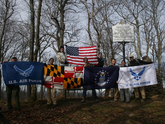
Nearest Base: 167th Air National Guard Base, WV Trip Date: Saturday 8 Nov 2014 Difficulty: Easy Trip Update: MISSION ACCOMPLISHED! The following seven airman and a friend pictured above hiked to the summit of Maryland on Saturday 8 November:
|

