
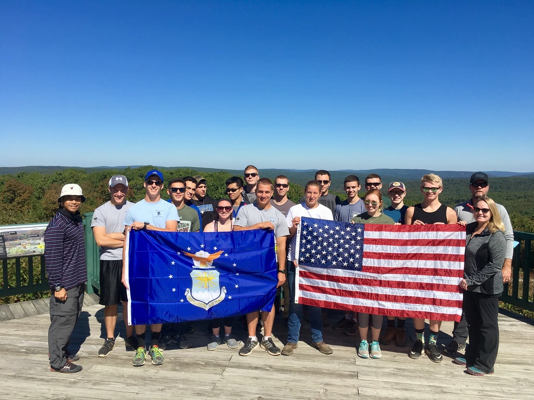
COMPLETED: 8 Oct 2016
|
Highpoint details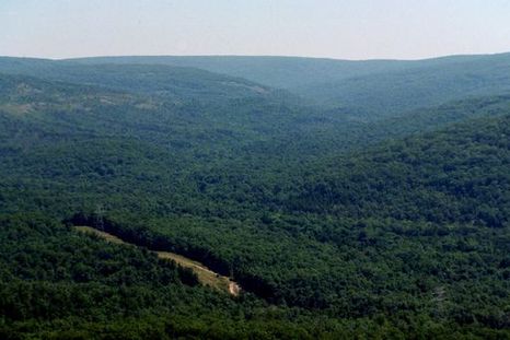
Taum Sauk Mountain in the Saint Francois Mountains is the highest natural point in the U.S. state of Missouri at 1,772 feet (540 m).The topography of Taum Sauk is that of a somewhat flat ridge rather than a peak.
While not as impressive at 1,772 feet (540 m) as other peaks, Taum Sauk and the St. Francois range are true mountains, being the result of a volcanic orogeny. Whereas vertical relief in the rest of the Ozarks region is the result of erosion of sedimentary strata, the St. Francois are an ancient Precambrian igneous uplift several times older than the Appalachians. Geologists believe that Taum Sauk and its neighbors may be among the few areas in the US never to have been submerged in ancient seas.[citation needed] The peaks of the St. Francois range existed as islands in the shallow seaway throughout most of the Paleozoic Era as the sandstones, limestones, and shales typical of the Ozarks were deposited. Weathering anderosion of these ancient peaks provided the clastic sediments of the surrounding rock layers. Taum Sauk is said to be named for a Piankeshaw chief named Sauk-Ton-Qua. In 1991 Missouri created Taum Sauk Mountain State Park, a 7,448-acre (30.14 km2) state park on the mountain: it has a rustic campground, a paved trail to the highpoint marked by a polished granite plaque, and a lookout tower from which a good view can be had; the dense forest on the mountain obscures the view from most other vantage points. Taum Sauk State Park is in a common jurisdiction with nearby Johnson's Shut-ins State Park, and together they comprise the second largest state park in Missouri with a total area of 15,961.5 acres (64.594 km2). These parks and the adjacent Bell Mountain Wilderness Area make up part of a large wilderness area that is very popular with hikers and backpackers. The 33-mile (53 km) Taum Sauk section of the Ozark Trail is considered by the Ozark Trail Association to be one of the finest trails in Missouri. Mina Sauk Falls, the highest waterfall in Missouri, is on Taum Sauk and can be visited by hiking a rugged trail that makes a 3-mile (4.8 km) loop from the highpoint parking area. These falls normally have water cascading over them only during times of wet weather. At other times they are reduced to a trickle or less. |
trip detailsFacebook Event: https://www.facebook.com/events/169937646771744/
Trip Leader: Jodi Ames Nearest Base: Whiteman AFB, Scott AFB, Lamber-St. Louis. Projected Date: Oct 8th, 2016 Difficulty: Easy (several mile hike) |
All trip updates and progress will be posted in the blog below