New Mexico: Wheeler Peak (13,161ft)
|
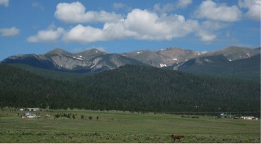
Highpoint detailsWheeler Peak is, at 13,167 feet (4,013 m), the highest peak in the U.S. state of New Mexico. It is located northeast of Taos and south of Red River in the northern part of the state, and just 2 miles southeast of the ski slopes of Taos Ski Valley. It lies in the Sangre de Cristo Mountains, the southernmost subrange of the Rocky Mountains.
Formerly named Taos Peak, after the nearby town of Taos, New Mexico, it was renamed Wheeler Peak in 1950.[4] A plaque at the summit states that the mountain was: Named in honor of Major George Montague Wheeler (1842–1905) who for ten years led a party of surveyors and naturalists collecting geologic, biologic, planimetric and topographic data in New Mexico and six other southwestern states. The standard route on Wheeler Peak is along the north ridge. The route starts at the parking lot for Taos Ski Valley, and proceeds east along an old road to a broad saddle at Bull-of-the-Woods Meadow. It then turns south and winds its way among minor peaks and small valleys to gain Wheeler Peak from the north, going over the summit of Mount Walter along the way. This is a practical route, even in winter, due to low (but nonzero) avalanche exposure. An alternate route is to hike south from Taos Ski Valley to Williams Lake, then take a newly constructed switchback trail to the top. This trail was completed in 2011 by a Forest Service trail crew from the Gallatin National Forest, 8 people working 12 hours per day, building 4 miles of new trail with hand tools to the top in 14 days. |
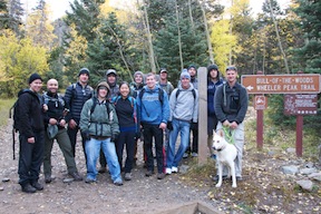
trip ReportThe Columbus Day weekend hike of Wheeler Peak in northern New Mexico brought together a diverse group of adventurers. Although organized by leaders from Kirtland AFB, friendships and family ties resulted in climbers from Kirtland AFB, Holloman AFB, and the US Air Force Academy, all with the common goal of standing on the highest point in the Sangre de Cristo mountains at the southern tip of the Rockies.
Climbing 13,161’ Wheeler Peak is a serious undertaking, so our group had decided to camp on Saturday night at the Bull-of-the-Woods trailhead at Taos Ski Valley, in order to have an early start on Sunday. Our arrival was greeted by sunshine, brilliant fall colors, and a dusting of fresh snow on the highest peaks in the range.
After a brief rain shower as we got a fire going and prepared dinner, the sun reemerged long enough to provide some classic Desert Southwest alpenglow. After sunset, we enjoyed our campfire and some great stargazing. With the clear, dry air at our elevation of almost 10,000’, the Milky Way was on full display. Thanks to one of our trip leaders, Jeff Harris of Kirtland’s Outdoor Recreation program, we were well equipped with good tents and sleeping bags. A generous sponsorship by Kirtland Federal Credit Union allowed us to rent any gear that individuals needed for the overnight, so our team slept well with no complaints. We had planned a simple hot breakfast of oatmeal with raisins, banana and brown sugar, which was quick to make with very little cleanup. We were ready to hit the trail by 0715.
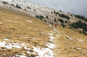
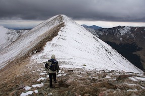
Our route to Wheeler Peak was via the Bull-of-the-Woods trail, a distance of some 7.5 miles. The trail rises steeply to the northeast along a mountain steam, and then turns south for a number of miles as it rises steadily along a long ridge line. The weather forecast called for variable conditions and a fair amount of wind, and as we reached the tree line at about 11,000’, the temperatures dropped into the 30s and the wind rose steadily. Still, the sun would occasionally break through and highlight the fall colors stretching out for miles in the valleys below us.
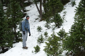
About 4 miles into the hike we crossed over the boundary into the Wheeler Peak Wilderness Area. Shortly thereafter, the trail descends into a gully, giving up about 400’ of hard–won elevation. Descending into the gully the sporadic snow turned to full ground cover, and the hike started to fell like even more of a winter adventure.
Climbing out of that gully back into the high alpine region, the effects of the altitude, now some 12,000’, really began to kick in. Slow and steady was the order of the day for most, although some of our climbers, including our two USAFA cadets, were able to maintain an impressive pace all the way to the summit. From here the trail enters a long series of switchbacks as it climbs along the western side of a huge, north-facing basin. (You can check out the topo map of our route here: http://www.summitpost.org/bull-of-the-woods-trail/gpx-map/747259) One of the themes of the 50 Summits Challenge is building resiliency, and the NM team had plenty of opportunity to demonstrate it here. As we neared the top of the basin, the wind really began to hammer us, although occasional breaks on the cloud cover gave us tantalizing glimpses of the summit of 13,141’ Mt. Walter. The second highest point in the state, we would traverse over that peak on our way to Wheeler.
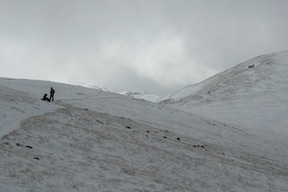
By the time the last of our group had reached the summit of Mt. Walter, it was past 1300, the wind was steady at 20-30 mph with gusts much stronger, and the base of the clouds was beginning to look more and more threatening. With occasional cracks of cloud-to-cloud lightning, we knew we had to move quickly.
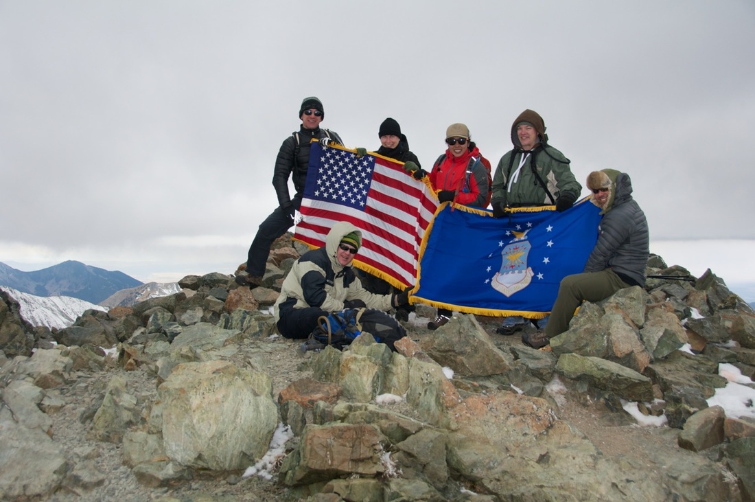
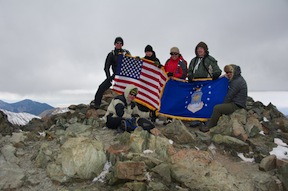
Our descent would take us down the Williams Lake Trail, a much more direct line of descent from the saddle between Mt Walter and Wheeler Peak. We hurried on across the saddle and up the final rise to tag the summit. Working our way up a steep section of trail over an exposed rocky knob, we passed the first members of our group on the way down, exchanging high-fives and congratulations. Our two USAFA cadets had carried the same Air Force flag that had been to the top of Colorado’s Mt. Elbert just a few weeks before, and it was good to feel that connection to other members of the 50 Summits project. After a few obligatory summit photos, it was time to retreat.
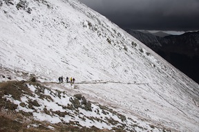
Because of the threatening clouds, the last few climbers in the group made the safe call and decided to skip the summit and head down towards Williams Lake from the saddle. After all, they’d already been within 20’ of the summit elevation, and Wheeler will still be there another day…and possibly a much warmer, less windy one! All in all, about 15 of our 19 climbers were able to tag the summit, not a bad showing. Those that didn’t make it this time made a sound call to get off the high ridges where the threat of a lightning strike is very real. We descended with all due haste into the switchbacks leading towards Williams Lake some 2000’ below us, taking care to choose our footing carefully as we crossed the many icy spots on the trail.
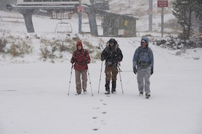
Getting off the summit ridge protected us from the worst of the wind, but by now the snow, which had been spitting intermittently, was falling lightly but steadily. Once we reached the treeline again on descent, we were in the midst of a full-on snowstorm. Fortunately, the trail was well marked and we made good time. The last two miles of the hike descended gently from Williams Lake back to Taos Ski Valley, and by the time the tail end of our group reached that section of trail, the footprints of those 30 minutes in front of us had already been filled in.
The last of our crew arrived back at the Bavarian Restaurant at about 3 pm. A long day, to be sure, but we’d covered over 11 miles with a net elevation gain of almost 4500, and successfully ticked the 8th highest state highpoint from the 50 Summits list. The camaraderie and teamwork of fellow Airmen made the experience that much more meaningful and rewarding, with much talk of future adventure over dinner that night.
|
All trip updates and progress will be posted in the blog below

