Quad SUMMIT Mega Trip: NC, TN, GA, SCThis is a unique 4-peak challenge. One of our most experienced volunteers will lead Airmen to the high points of NC, SC, GA, and TN, all in one event. It's an exciting twist for us and we hope you will take part in this quad summit challenge!
North Carolina: Mt. Mitchell
| |||||||||
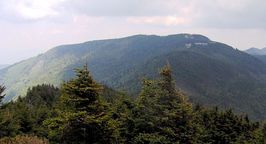
Highpoint detailsMount Mitchell is the highest peak of the Appalachian Mountains and the highest peak in the eastern United States. It was the highest point in any state of the United States until Texasjoined the union in 1845. The nearest higher point is Lone Butte in Colorado, 1189 miles (1913 km) west. Mount Mitchell is located near Burnsville in Yancey County, North Carolina, in the Black Mountain subrange of the Appalachians, and about 32 miles (51 km) northeast of Asheville. It is protected by Mount Mitchell State Park and surrounded by the Pisgah National Forest.
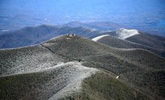
The mountain was named after Elisha Mitchell, a professor at the University of North Carolina, who determined its height in 1835, and fell to his death at nearby Mitchell Falls in 1857, having returned to verify his earlier measurements. There are several options for reaching the summit, some very easy and some a requiring moderate hiking. Unlike the lower elevations in the surrounding regions, heavy snows often fall from December to March, with 50 inches (127 cm) accumulating in the Great Blizzard of 1993.[6] Snow flurries have been reported on the summit even in the summer months of June, July, and August. Due to the high elevation, precipitation is heavy and reliable year-round, averaging 74.7 inches (1,900 mm) for the year, with no month receiving less than 5 in (127 mm) of average precipitation. The summit is often windy, with gusts that can blow up to 178 mph (286 km/h).[7] Clingmans Dome (or Clingman's Dome) is a mountain in the Great Smoky Mountains of Tennessee and North Carolina, in the southeastern United States. At an elevation of 6,643 feet (2,025 m), it is the highest mountain in the Smokies, the highest point in the state of Tennessee, and the highest point along the 2,174-mile (3,499 km) Appalachian Trail. East of theMississippi River, only Mount Mitchell (6,684 feet or 2,037 metres) and Mount Craig (6,647 feet or 2,026 metres) are higher. Clingmans Dome has two subpeaks: 6,560-foot (2,000 m) Mount Buckley to the west and 6,400-foot (1,950 m) Mount Love to the east. The headwaters of several substantial streams are located on the slopes of Clingmans Dome, namely Little River on the north slope, and Forney Creek and Noland Creek (both tributaries of the Tuckasegee River) on the south slope. The mountain is located entirely within the Tennessee River watershed.[3] Clingmans Dome is protected as part of the Great Smoky Mountains National Park. A paved road, closed from December 1 through March 31,[3] connects it to U.S. Highway 441(Newfound Gap Road). The concrete observation tower, built in 1959, offers a panoramic view of the mountains in every direction. An air quality monitoring station, operated by the Environmental Protection Agency, is the second highest in eastern North America. Reputedly known as "Kuwahi" (the mulberry place) by the Cherokee Indians, the mountain was dubbed "Smoky Dome" by American settlers moving in from other areas. In 1859, the mountain was renamed by Arnold Guyot for compatriot Thomas Lanier Clingman[4] (1812–1897), an American Civil War general who explored the area extensively in the 1850s and then spent many years promoting it. Guyot named the mountain for Clingman because of an argument between Clingman and a professor at the University of North Carolina, Elisha Mitchell, over which mountain was actually the highest in the region. Mitchell contended that a peak by the name of Black Dome (now known as Mount Mitchell) was the highest, while Clingman asserted that Smoky Dome was the true highest peak. Guyot determined that Black Dome was 39 feet (12 m) higher than Smoky Dome. Clingmans Dome is the most accessible mountain top in the Great Smoky Mountains National Park. Closed from December 1 through March 31,[3] the 7-mile (11 km) Clingmans Dome Road begins just past Newfound Gap and leads up the mountain to the Forney Ridge Parking Area, 300 feet (91 m) below the summit. A half-mile (800 m) paved trail leads from the parking lot to the 54-foot (16 m) observation tower at the top of the mountain.[9] The short, steep trail provides a small visitor information center and park store staffed by the Great Smoky Mountains Association, garbage cans, and numerous benches to the side of the path. Vault toilet restrooms are available. The trail offers a glimpse of the often hostile environment of highland Appalachia, passing through the spruce-fir forest and its accompanying blowdowns and dead Fraser Firs. The observation tower allows spectators a 360 degree panorama of the surrounding mountains, on the infrequent occasion of a clear, sunny day. Cantilevered signs, hanging from the rails of the tower, point out the various peaks, ridges, cities, and other features visible in the distance. Depending on the haze, visibility ranges from 20 miles (32 km) on hazy days to 100 miles (160 km) on very clear days. The Appalachian Trail crosses Clingmans Dome, passing immediately north of the observation tower. A 7.5-mile (12.1 km) leg of the trail connects the mountain with Newfound Gap, and provides the only non-overnight access to the mountain in winter months. The nearest A.T. backcountry shelters are the Double Spring Gap Shelter, which is 2.6 miles (4.2 km) to the west near the Goshen Prong junction, and the Mount Collins shelter, which is 4 miles (6.4 km) to the east near the A.T.'s Sugarland Mountain Trail junction. Clingmans Dome is the base for several additional hiking trails, including the Forney Ridge Trail (to Andrews Bald) and the Forney Creek Trail (to the Benton MacKaye Trail on the shores of Fontana Lake). The western terminus of the Mountains-to-Sea Trail, which connects the Smokies to the Outer Banks of North Carolina, is located atop Clingmans Dome. It follows the Appalachian Trail for 3.8 miles (6.1 km) to the east, where it then begins to descend toward the Blue Ridge Parkway, via the Fork Ridge Trail. Brasstown Bald is the highest natural point in the state of Georgia, USA, with a summit elevation of 4,784 feet (1,458 m) above mean sea level. The mountain is known to the native Cherokee people as Enotah.[2] It is named for the former Cherokee village of Brasstown, Georgia, located along the upper Brasstown Creek. Across the North Carolina state line, immediately to its north, is Brasstown, North Carolina, in the Brasstown township of Clay County, North Carolina. Brasstown Bald is partly in Towns and partly in Union counties, the peak being divided by the county line. The mountain is part of the Blue Ridge Mountains (part of the Appalachian Mountains), and within the borders of the Blue Ridge Ranger District of the Chattahoochee National Forest. The mountain is mostly made up of soapstone and dunite. On a clear day, it is possible to see the tall buildings of Atlanta from the summit. The U.S. Forest Service has webcams atop the observation tower, and a RAWS weather station further down the mountain. The public can drive to the top via Georgia state route 180 Spur. According to the two Georgia historical markers, the area surrounding Brasstown Bald was settled by the Cherokee people. White settlers derived the word Brasstown from a translation error of a Cherokee word. Sounding very similar to another Cherokee word, settlers confused the word "Itse'yĭ" (New Green Place or Place of Fresh Green) with "Ûňtsaiyĭ" (Brass). Itse'yĭ, New Green Place, is a Cherokee locative name given to several distinct areas in the Cherokee world, including an area to the North of Brasstown Bald in North Georgia. Cherokee legend tells of a great flood that swept over the land. Everyone that inhabited the land died except a few Cherokee families that sought refuge in a giant canoe. The canoe ran aground at the summit of the mountain. Having no wild game to hunt and no place to plant vegetation, the Great Spirit killed all of the trees on the top of the mountain so the surviving people could plant their crops. They continued planting until the water subsided. While the Cherokee legend tells of a treeless mountain top, the term "bald" is common mountain terminology describing mountaintops that have 360-degree unobstructed views. The official name that includes the word Bald in this case was not intended to suggest a once-treeless mountaintop, the way the term is used for most other Appalachian balds. Sassafras Mountain is the highest point in the state of South Carolina, USA. It is in the Blue Ridge Mountains, part of the Appalachian Mountains. It is located along the South Carolina - North Carolina border in northern Pickens County, South Carolina nearest to the town of Rosman, North Carolina. From I-85 Exit 21 in South Carolina, one can reach Sassafras Mountain by driving north on US-178 until reaching the unincorporated community of Rocky Bottom. From there, take F. Van Clayton Highway (a local road) about 4.7 miles (7.6 km) to the parking lot at the top. From Rosman, follow US-178 south. The summit is an easy 300 foot walk from the parking lot and is, by merit of not having stairs, handicapped accessible, although the path is fairly steep. |
trip detailsFour summits in less than two days---don't miss this fun filled event. You can join in for just one or all four summits, or something in between. Highlights include:
-Group camping in the Blue Ridge and Great Smoky Mountains NP on Fri/Sat nights -Summit Mt. Mitchell and Sassafrass Mt. on Saturday, 11 Oct -Summit Clingmans Dome and Brasstown Bald on Sunday, 12 Oct Trip Leader: Lt Col Jeffrey Armentrout Planned Date: 10-12 October 2014 Difficulty: Moderate Itinerary highlights: Fri night: camping at Briar Bottom CG, NC Sat 1130: Mt Mitchell, NC summit Sat 1500: Sassafrass Mt, SC summit Sat night: camping in Smoky Mt NP Sun 0900: Clingmans Dome, TN summit Sun 1230: Brasstown Bald, GA summit DOWNLOAD THE FINAL ITINERARY:
View Driving directions to Brasstown Bald Visitors Center, Blairsville, GA in a larger map | ||||||
All trip updates and progress will be posted in the blog below


