Oregon: Mt. Hood (11,239ft)
|
Highpoint detailsMount Hood, called Wy'east by the Multnomah tribe, is a stratovolcano in the Cascade Volcanic Arc of northern Oregon. It was formed by a subduction zone on the Pacific coast and rests in the Pacific Northwest region of theUnited States. It is located about 50 miles (80 km) east-southeast of Portland, on the border between Clackamas andHood River counties. In addition to being Oregon's highest mountain, it is one of the loftiest mountains in the nation based on its prominence.
Mount Hood is Oregon's highest point and a prominent landmark visible up to 100 miles (160 km) away. It has convenient access and a minimum of technical climbing challenges. About 10,000 people attempt to climb Mount Hood each year.[44] There are six main routes to approach the mountain with about 30 total variations for summiting. The climbs range in difficulty from class 2 to class 5.9+ (for Arachnophobia).[45] The most popular route, dubbed the south route, begins at Timberline Lodge and proceeds up Palmer Glacier to Crater Rock, the large prominence at the head of the glacier. The route goes east around Crater Rock and crosses Coalman Glacier on the Hogsback, a ridge spanning from Crater Rock to the approach to the summit. The Hogsback terminates at a bergschrund where Coalman Glacier separates from the summit rock headwall, and then to Pearly Gates, a gap in the summit rock formation, then right onto the summit plateau and the summit proper.[46] |
trip Report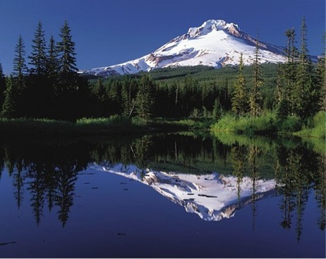
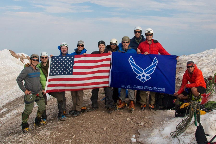
Trip Leader: Maj Rob Marshall
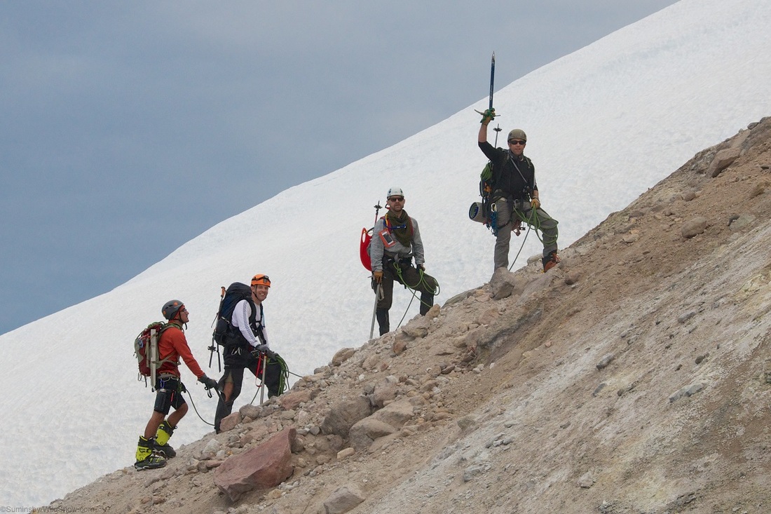
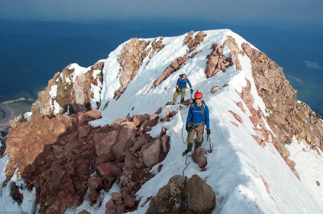
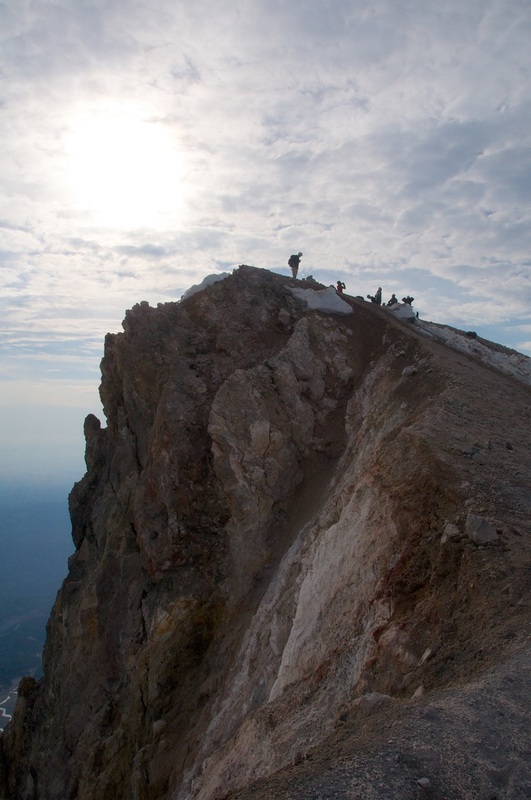
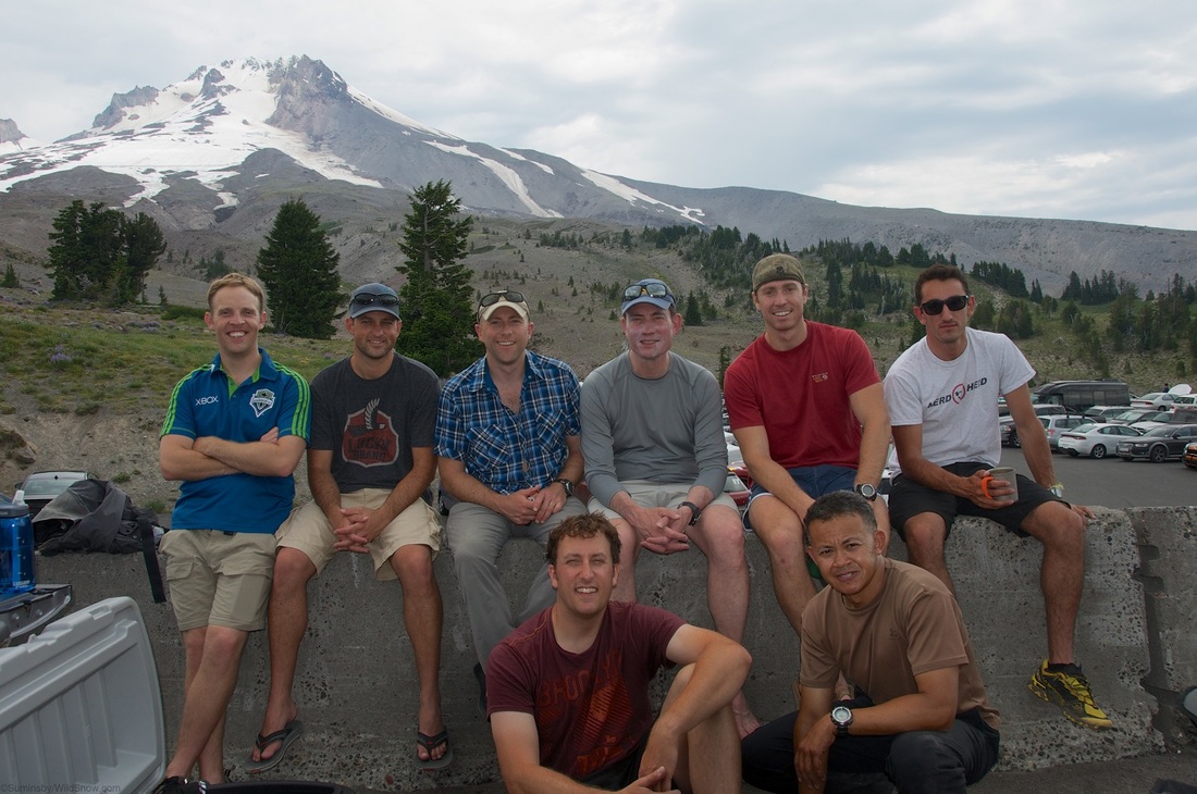
Nearest Base: JBLM, Klamath Falls ANG Projected Date: 26-27 Jun Difficulty: Moderately Technical This was a classic mountaineering climb! And it couldn't have gone better. 10 Airmen met at the Timberline Lodge for food and drinks on Friday evening, discussed the climb/gear/risk management, and cheered on the US Women's Nat'l Soccer Team as they beat China in the World Cup. After that, we packed up our gear, laid down in the overnight parking lot for an hour or two of rest, and at 1145pm we were up to prep for the alpine start. After coffee, oatmeal, and double checking each other's gear, the team started up the mountain at half past midnight. Mt. Hood is a physically demanding hike because it is usually done in one day and requires a long, uphill hike/climb. Right away, we discussed and practiced the "rest step", which is essential to setting an efficient pace while traveling uphill. We hiked by headlamp as all climbers got to know each better. There are many meandering trails and routes, but we generally stayed right of the chairlift as the route went from rock to snow. The conditions on the mountain were unusually warm, resulting in soft snow conditions. After an hour or two of hiking on the snow in boots, we switched to crampons to limit the amount of sliding in the soft, wet snow. We reached the Devil's Kitchen shortly after sunrise. Here you smell lots of sulfur and see steam coming from the exposed rocks/dirt. Our team roped up at this point, separating into three rope teams led by our more experienced Airmen. There were several rock falls in the area and a recent point release avalanche, but we found our route to be stable enough to press up from across the fumarole. Using the "Old Route" chute, the team used ice axes to gain a grip on the steep, soft snow and made nice time to the summit ridge. After walking just below the steep summit ridge (what a view... glad to be roped, eh?!), all ten of our Airmen celebrated on the summit of Mt. Hood. Pushups and photos with flags complete, the team quickly moved off the summit to limit our exposure to the warming upper mountain. It's a long, tough walk down... skis are a good idea. But spirits were high and we made it back to the parking lot around noon. That's approx 12hr roundtrip. Props to the Airmen who had never used crampons/ice axes/ or traveled roped up... way to work together and push your personal limits. The view from the top is worth it. -Maj Rob "Goat" Marshall |
All trip updates and progress will be posted in the blog below