Virginia: Mt. Rogers (5,729ft)
Ranked #19/50
COMPLETED: 8 Nov 2014
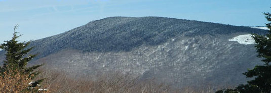
Highpoint detailsMount Rogers is the highest natural point in the Commonwealth of Virginia, USA, with a summit elevation of 5,729 feet (1,746 m) above mean sea level. It lies in Grayson and Smyth Counties, Virginia, about 6.45 miles (10.38 km) WSW of Troutdale, Virginia, within the Mount Rogers National Recreation Area and Jefferson National Forest.
The mountain is named for William Barton Rogers, a Virginian educated at the College of William & Mary, who taught at William & Mary and the University of Virginia, became Virginia's first State Geologist,[3] and went on to found the Massachusetts Institute of Technology. The summit is most easily accessed from Grayson Highlands State Park by following the Appalachian Trail southbound for 3.5 miles (5.6 km) to a blue-blazed trail leading to the summit, which is covered by trees and marked with four National Geodetic Survey triangulation station disks; a standard station disk marked with an equilateral triangle and three standard reference disks marked with arrows pointing towards the station disk. Because the Appalachian Trail passes within a half mile of the summit, the area is especially popular with hikers. |
Trip Report(Report from MSgt Lee Blakeney, trip leader for VA.)
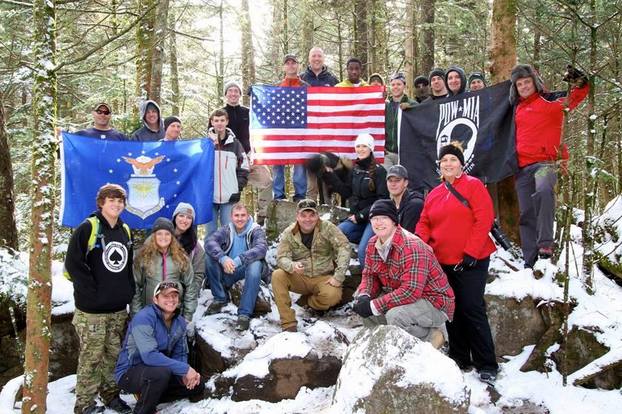
Mt Rogers VA was a huge success. We tackled the VA High point with 19 Airmen, 5 family members and even a soldier, 25 people total. The team included 2 Chief Master Sergeants, 1 Senior Master Sergeant, a soldier and a sponsor from Beyond Clothing who brought his family and sponsored some guys from the group with some base layers. There were Airmen From Dover, Langley, Ft Bragg, and The Pentagon. We had 2 teams, one team completed a 14 mile total hike and almost 2000 feet of elevation to get to the top. The second team hiked 8 miles and was led by a Wounded Warrior. The group braved camping overnight in temps in the low 20s. Getting to the summit involved camping Friday and Saturday nights and it required passing some amazing viewpoints on the Appalachian Trail. We talked with some local and AT through hikers and got to visit with the wild ponies that live in the Mt Roger Wilderness. We had complete success with no casualties, and I put the word out that NC was still available. I had one person who wanted to do the summit but couldn't make this trip ask if the 50 summits would be annual thing. I don't know if there would be a way to automate the website or something to allow folks to set up recurring summits or something (something easier than a single person having to coordinate the management of the trips). But if there is a way to do it I think that would be cool, and would allow a lot more Airmen to experience the summits. Thanks for putting this together. It was a great opportunity for me to bring these folks all together, and everyone enjoyed the experience. I will be keeping an eye on the page for any more opportunities to hit other summits. trip detailsTrip Leader: Lee Blakeney
Projected Date: Nov 7-8 2014 Difficulty: Moderately Easy: You can choose between a 7.5mi or 3mi option. Follow our FB Event: https://www.facebook.com/events/1555231231358695/ |


