The 2017 Kings Peak expedition was a success! At 1000 hrs on 24 July, we achieved the 13,534' summit. Special thanks to our charity supporters, who, in the name of this trip, donated to the That Others May Live Foundation (http://www.thatothersmaylive.org/), the Special Operations Warrior Foundation (http://specialops.org/), or any other of the many veterans charities. Here's a timeline of the trip:
Friday, 21 July
0730: Departed Hill AFB
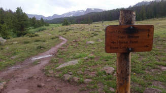
1030: Arrived at Henry's Fork Trailhead, in time for a torrential hail and lightning storm! People coming down the mountain were soaked.
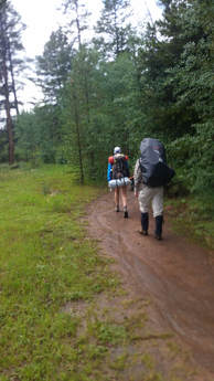
1200: Departed up the trail, ~7.5 miles to Dollar lake. Ongoing rain showers ensured the trail was muddy, and the river was high.
0730: Departed Hill AFB
1030: Arrived at Henry's Fork Trailhead, in time for a torrential hail and lightning storm! People coming down the mountain were soaked.
1200: Departed up the trail, ~7.5 miles to Dollar lake. Ongoing rain showers ensured the trail was muddy, and the river was high.
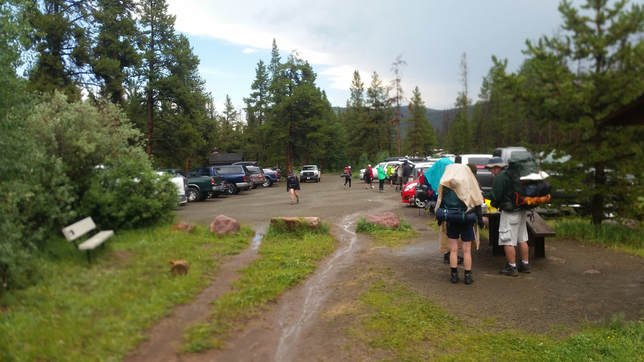
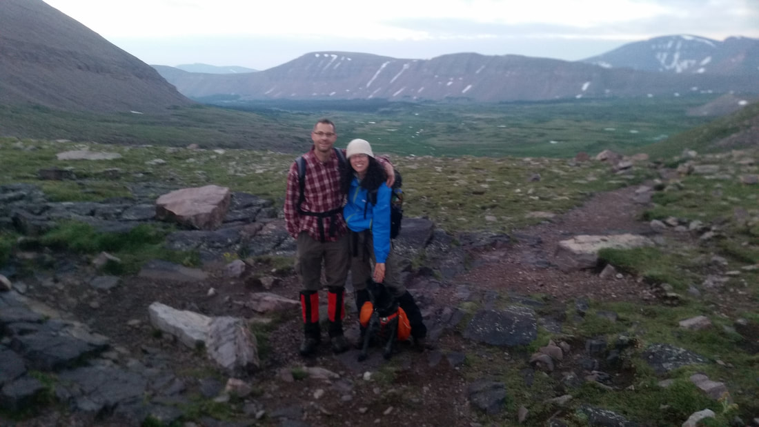
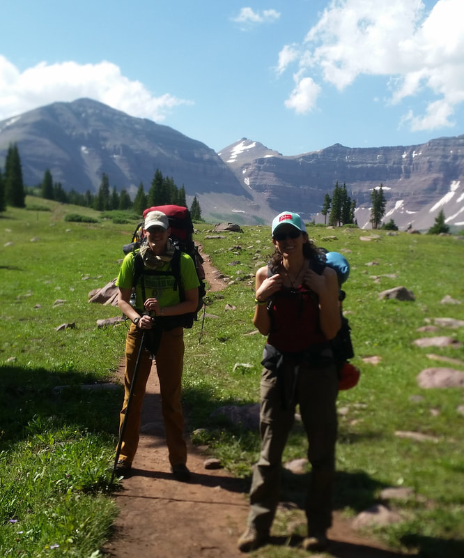
Henry's Fork Trailhead
 | 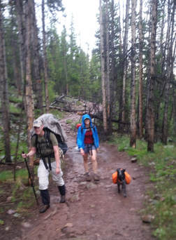 Tim, Kelly, and Otter. Staying dry-ish! |
Our first view of Kings Peak! In the far background, through the vertigo-inducing Anderson Pass.
1700: Arrived at Dollar Lake base camp. I wouldn't say "crowded," which is often used to describe this popular camping area, but I would definitely call it "popular!" The sun peeked through the clouds at the end of the day, treating us to a spectacular, high Uinta sunset.
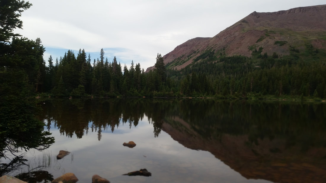
Dollar Lake
Saturday, 22 July
0300: Alarm clock rings for an alpine start!
0415: After a breakfast of oatmeal and fruit, we departed base camp for Kings Peak via Gunsight Pass. Clear, starry, moon-less skies were our reward for getting up so early.
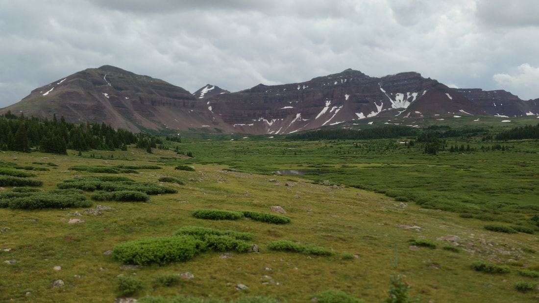
0630: Gained Gunsight Pass. Great views into the upper Uinta River basin on the far side! We headed westward on the Gunsight Cutoff "trail" toward Anderson Pass, on the southern flank of the unnamed (?) 13,103-foot mountain between the passes. Unfortunately, a member of the group had come to experience intolerable altitude symptoms. Turning back is a hard choice, but in this case it was the correct action. Kudos for making the right call, before getting into a bad spot. We kept in radio communication, and the rest of the team continued on.
0300: Alarm clock rings for an alpine start!
0415: After a breakfast of oatmeal and fruit, we departed base camp for Kings Peak via Gunsight Pass. Clear, starry, moon-less skies were our reward for getting up so early.
0630: Gained Gunsight Pass. Great views into the upper Uinta River basin on the far side! We headed westward on the Gunsight Cutoff "trail" toward Anderson Pass, on the southern flank of the unnamed (?) 13,103-foot mountain between the passes. Unfortunately, a member of the group had come to experience intolerable altitude symptoms. Turning back is a hard choice, but in this case it was the correct action. Kudos for making the right call, before getting into a bad spot. We kept in radio communication, and the rest of the team continued on.
 Malcolm, Kelly, and Otter at Gunsight Pass | 0800: More fantastic views from Anderson Pass, looking down upon Henry's Fork Lake, Dollar Lake, and the upper valley The final push up the north ridge of Kings Peak was tough! It's steep, rocky, poorly marked, and punctuated by false summits. Yet we were overwhelmed by amazing views of Mt. Wilson and the western Uintas in the distance. A few marmots chirped at us as we passed. |
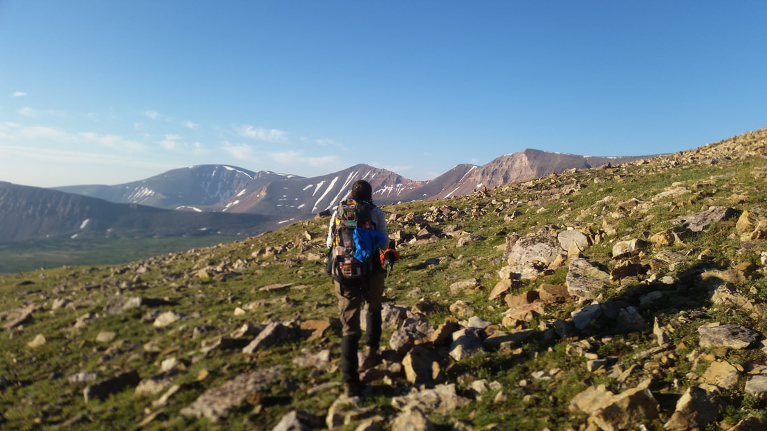
Traversing the Gunsight Cutoff trail toward the backside of Anderson Pass. Kings Peak just out of sight to the right.
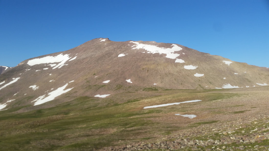
The broad, west face of Kings Peak! "Utah's Highest Ski Slope"
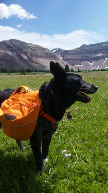
 Dashes mark our trail up the north ridge. | 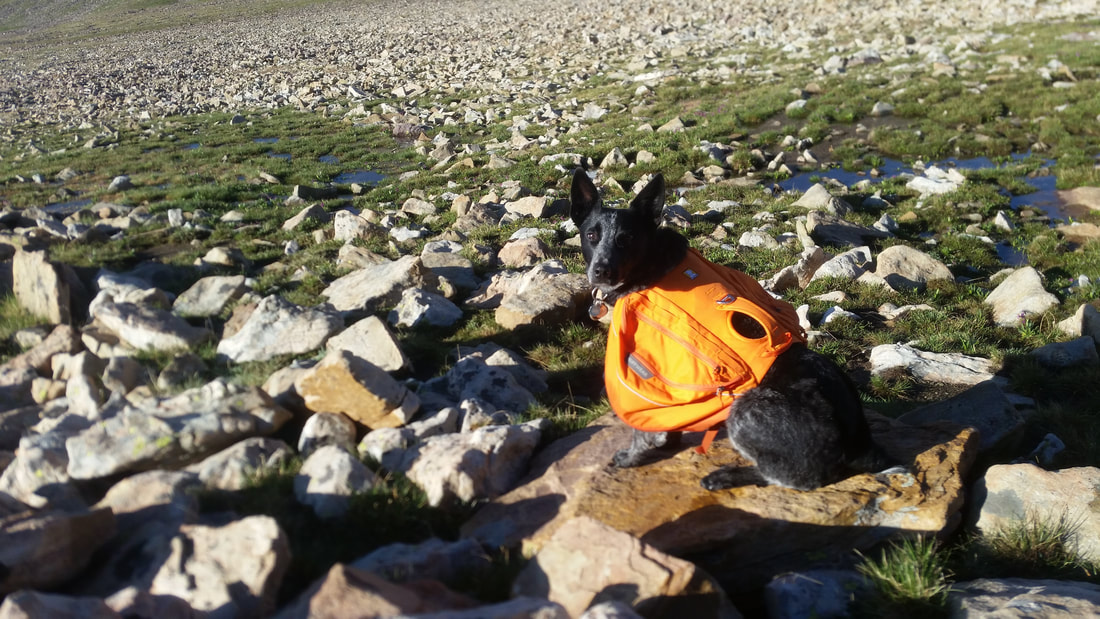 "We're climbing what?! This hike looks ruff!" |

Henry's Fork, seen from the precipitous top of Anderson Pass
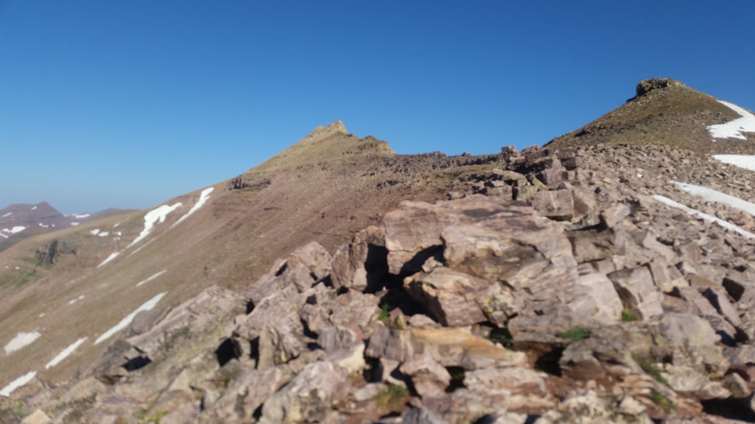
On the north ridge
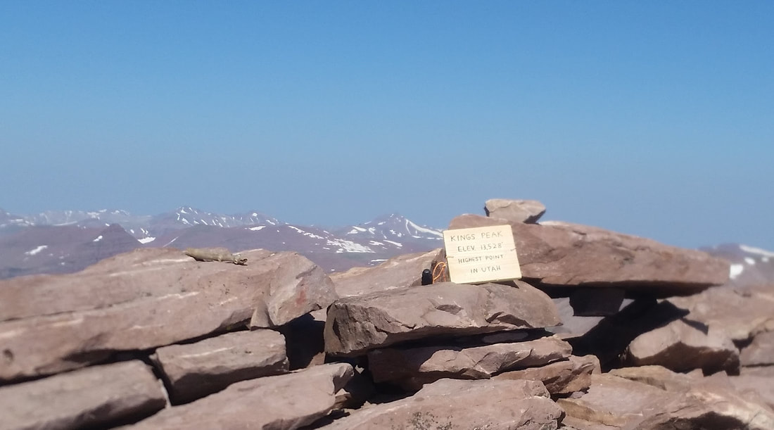
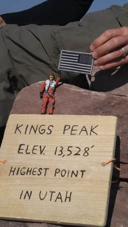
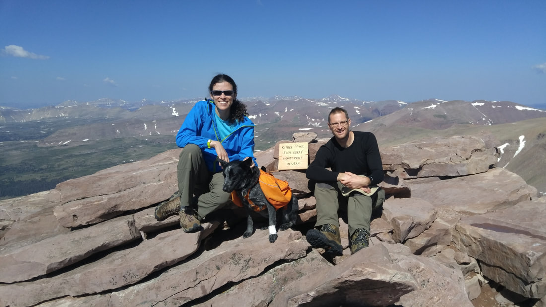
1000: Summit achieved! And, a well-deserved rest. Our early start ensured that the trail was uncrowded. We shared the summit with one other party, though we passed several others on the way down. Despite a few patches of snow here and there, the crampons and axes that we were advised to carry were utterly unnecessary. Some hikers wore sneakers, and Otter met many doggy friends along the way. On the way down, we passed some fast-movers who left the parking lot trailhead at 0530 that morning!
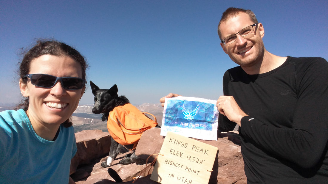
Due to an unfortunate situation, we ended up without any of our big flags for the summit pic... but we did have a water-logged printout of the Air Force Flag, and a patch as a back-up. We better go back and do it again properly!!
1545: The scree and rough terrain ensured the descent was no easy stroll, but everyone appreciated descending into thicker oxygen, and we made it back to base camp by mid-afternoon. The forecast rain never materialized-- we totally lucked out with the weather! Tim was feeling much better after his descent and quality rest at camp. We enjoyed a hearty dinner of frying-pan pepperoni pizzas made from scratch, and collapsed into our sleeping bags before sunset.
Sunday, 23 July
After a leisurely sleep-in, and breakfast of hash browns and eggs, we cleaned up camp and headed back down the Fork. We spotted a large herd of mountain goats, and a moose, on the way down. Some light rainshowers reaffirmed our fantastic luck with the weather yesterday. After a round trip of 28 miles, the car was a welcome sight, by mid-afternoon. Thunder had been following us all the way down, and we were glad to beat the worst of it! The rain didn't diminish the great experience in the slightest. Hard to believe how fast this trip had gone!
-Malcolm
 |  |
 RSS Feed